Civil War Geography
1. Introduction- Explore the US during the Civil War
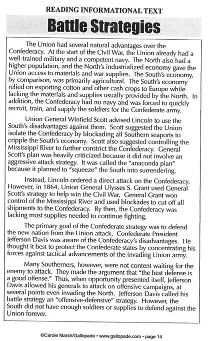
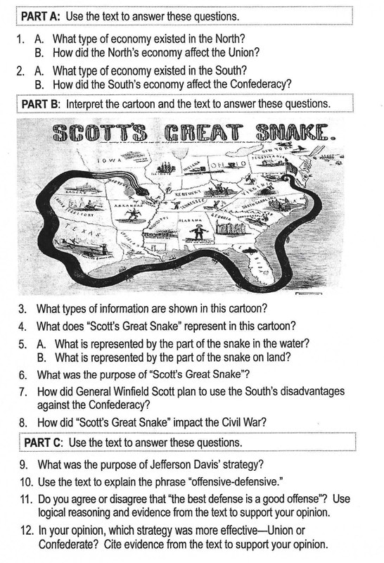
Reading Activity-> Battle Strategies
|
|
|
Answer the questions in Google Classroom.
|
|

|
2. Map Activity
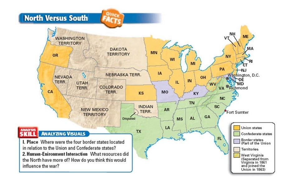
Things to Label1. Label the names of each state.
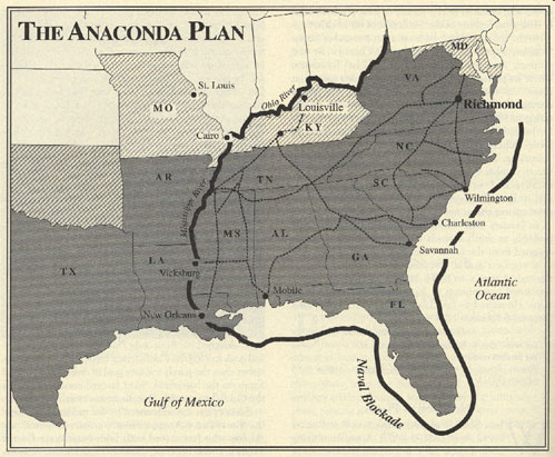
2. Label the name of each territory 3. Put a star and label the two capitals ---> Washington DC ---> Richmond 4. Make a dot and label Fort Sumter 5. Use a Sharpie to draw a line where Major General Winfield Scott set up a naval blockade. (The Anaconda Plan) |
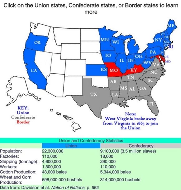
Things to Color1. Color all of the Union states color #1
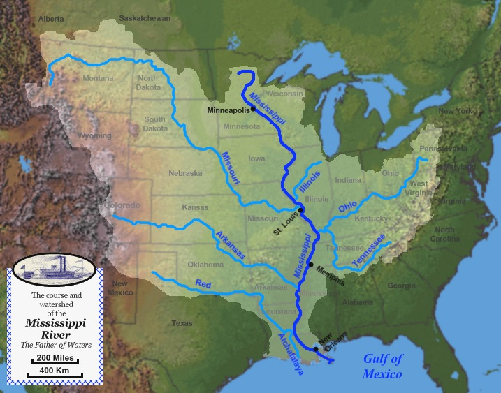
2. Color the Border states color #2 3. Color the Confederate states color #3 4. Color all of the territories color #4 5. Color all of the rivers and the lakes blue ---> Mississippi River ---> Ohio River ---> Great Lakes |
|
|
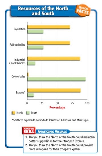
3. Resources of the North and the South
|
Go to Socrative to take a quiz on the geography and resources of the North and South during the Civil War.

|
Extending the Lesson...
See if you can complete the States and Advantages challenges.